 |
The Bulletin compiles news from in and around the US South. We hope these posts will provide space for lively discussion and debate regarding issues of importance to those living in and intellectually engaging with the US South.
After over a decade of research and surveying, North Carolina and South Carolina have reached an agreement on the official 335-mile border line between the two states. As noted by AP reporter Jeffrey Collins, the roots of the disputed border line go back to a 1735 order from King George II to draw a boundary between North and South Carolina. His instructions were to draw a line which began thirty miles south of the Cape Fear River and extended northwest to thirty-five degrees latitude; the border would then be drawn due west until it reached the Pacific Ocean. The original boundary was marked by hatchet marks on trees, strategically placed rocks, and other natural markers which have long since disappeared. Kim Severson of The New York Times reported that the two states formed a joint boundary commission in the mid-1990s after a border dispute arose when South Carolina bought some land near the border from the North Carolina-based power company Duke Energy. Since the 1990s, geographers, historians, and surveyors have used global positioning technology to draw a more precise border between the two Carolinas. The newly agreed upon border will result in ninety-three properties changing from one state to the other, as reported by Nick Carbone of Time magazine's Newsfeed Blog.
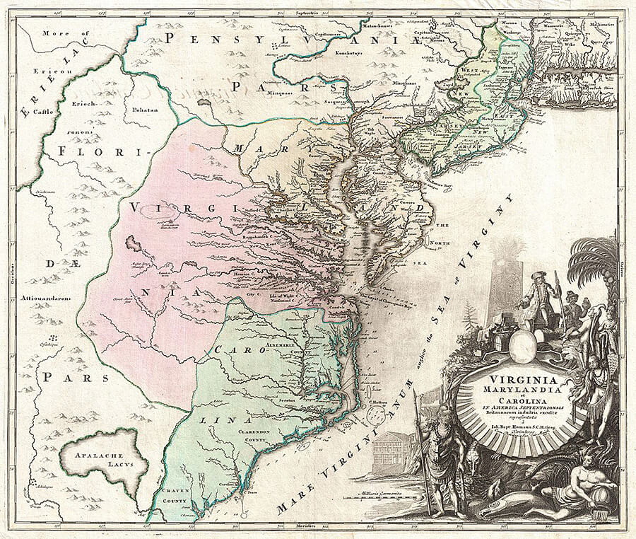
The border between North Carolina and South Carolina has been redrawn numerous times over the course of British colonial and United States history. The map below illustrates the colony of Carolina in the year 1715, before it was divided by the British crown in the wake of disputes over governance.
| Johann Homann, "Virginia Marylandia et Carolina in America Septentrionali Britannorum industria excultae . . .," 1715. Via Wikimedia Commons. |

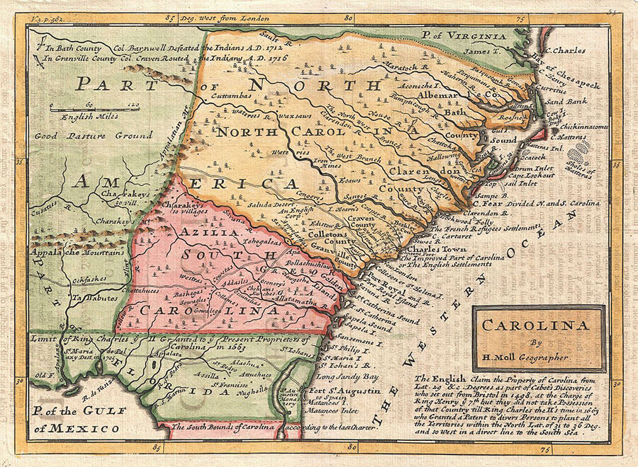
This next map illustrates the border between the colonies of North Carolina and South Carolina in 1746, which had been extended to the Appalachian Mountains, seventeen years after the colony of Carolina was officially split in two in 1729. When this map was drawn, Charles Town was located in the colony of North Carolina.
| Herman Moll, "Map of Carolina," 1746. Via Wikimedia Commons. |

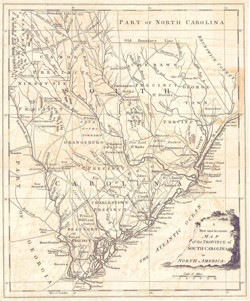
This map of the state of South Carolina in 1779 illustrates the border which was drawn between the colonies of North Carolina and South Carolina in 1772—the same border that present-day researchers sought to recreate aided by GPS technology. The border between the two states was drawn significantly farther to the north (beginning on the coast at Cape Fear) than the colonial border of 1746 represented above in which North Carolina's southern border followed the Savannah River.
| J. Hinton, "A New and Accurate Map of the Province of South Carolina in North America," 1779. From The Universal Magazine, courtesy of the Historical Maps of Alabama Collection, University of Alabama Department of Geography. Via Wikimedia Commons. |

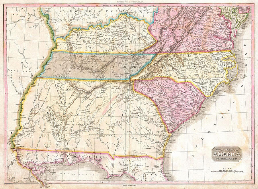
This 1818 map shows the states of North Carolina and South Carolina, with new western borders, prior to the Civil War. South Carolina's northwestern border in 1818 encompassed terrain formerly identified as "Cherokees Country" in the map from 1779.
| John Pinkerton, "United States of America Southern Part," 1818. From Pinkerton, J., A Modern Atlas, from the Latest and Best Authorities, Exhibiting the Various Divisions of the World with its chief Empires, Kingdoms, and States; in Sixty Maps, carefully reduced from the Larges and Most Authentic Sources (Philadelphia: Thomas Dobson Edition, 1818). Via Wikimedia Commons. |

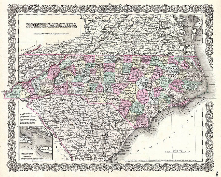
This 1855 map of North Carolina illustrates the border between the two states immediately prior to the Civil War. The border between South Carolina and Georgia dipped farther south to the Savannah River than in 1818, and the western borders of both states are more clearly defined in this later map.
| Joseph Hutchins Colton, "North Carolina," 1855. From Colton, G. W., Colton's Atlas of the World Illustrating Physical and Political Geography, vol. 1 (New York, 1855). Via Wikimedia Commons. |
. Via Wikimedia Commons.")